The Cookie Edit

Illustration
2021

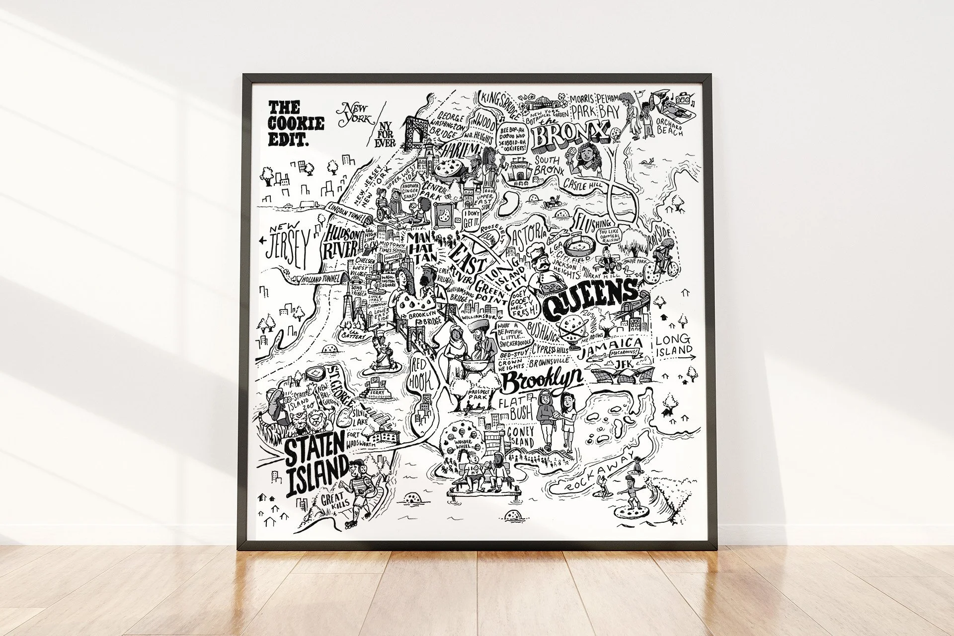
In the height of the pandemic, New York Magazine partnered with NYForever to create The Cookie Edit: a limited-edition curated box of 12 cookies from around the 5 boroughs with all proceeds benefitting ROAR, an organization helping the city’s restaurant workers. New York commissioned me to create a limited-edition, hand-illustrated, black and white print featuring a jam-packed map of New York City full of hand-lettering, city-dwelling characters, and plenty of cookie references (of course) throughout.

Text in artistic font reading 'New York / NY for Ever' with a slash separating the two phrases.
A hand-drawn illustrated map of New York City highlighting neighborhoods and landmarks such as Manhattan, Brooklyn, Queens, Staten Island, and the Bronx, with details of tunnels, bridges, parks, and popular locations.
A group of people looking at a painting of a cookie in a museum, with a speech bubble saying "I don't get it."
A black and white illustrated map of Brooklyn with landmarks like Coney Island, Brooklyn Bridge, and Rockaway, featuring sketches of people enjoying the area, rides, and food.
A black and white drawing of the Statue of Liberty, holding a rolling pin, shown on a small island with water surrounding it.
A detailed illustrated map of New York City neighborhoods including Bronx, Harlem, Brooklyn, Queens, and surrounding areas, with landmarks, streets, and illustrations of people and activities.
A black and white drawing of a person riding a bicycle with two large, cookie shaped wheels. The person has curly hair, is wearing a backpack, and is leaning forward as they pedal.
A framed illustrated map of New York City highlighting neighborhoods such as Queens, Brooklyn, Staten Island, Manhattan, Bronx, and areas like Long Island and Rockaway. The map features cartoon drawings of landmarks, people, and activities associated with each area.

Illustration(s) by Russell Shaw for Vox Media